What am I going to learn in Geography?
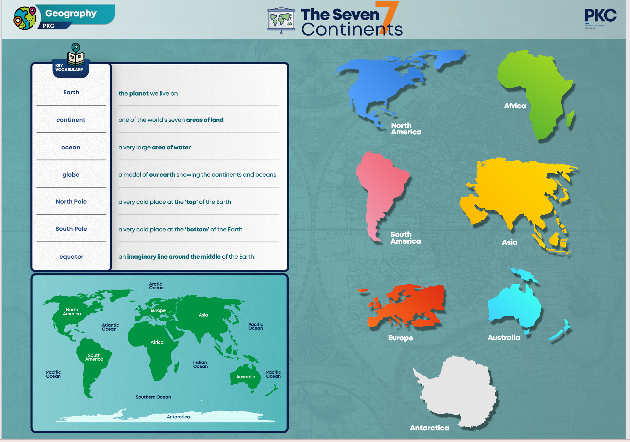
Year 1 – Continents
Children will use globes and will begin to understand that a globe is a 3D model of our Earth showing continents and oceans. They will learn to recognise the north and south poles and the equator and will begin to understand what geographic location can tell us about climate. Throughout this unit, children will be forming an understanding that the world is a diverse place, and continents can host many different landscapes and living things. They will encounter new and ambitious vocabulary that features throughout the unit, offering children many opportunities to rehearse and apply it. Children will be introduced to the disciplinary concept of interconnection through examples such as human impact on our oceans and the creation of the rice terraces in the Philippines.
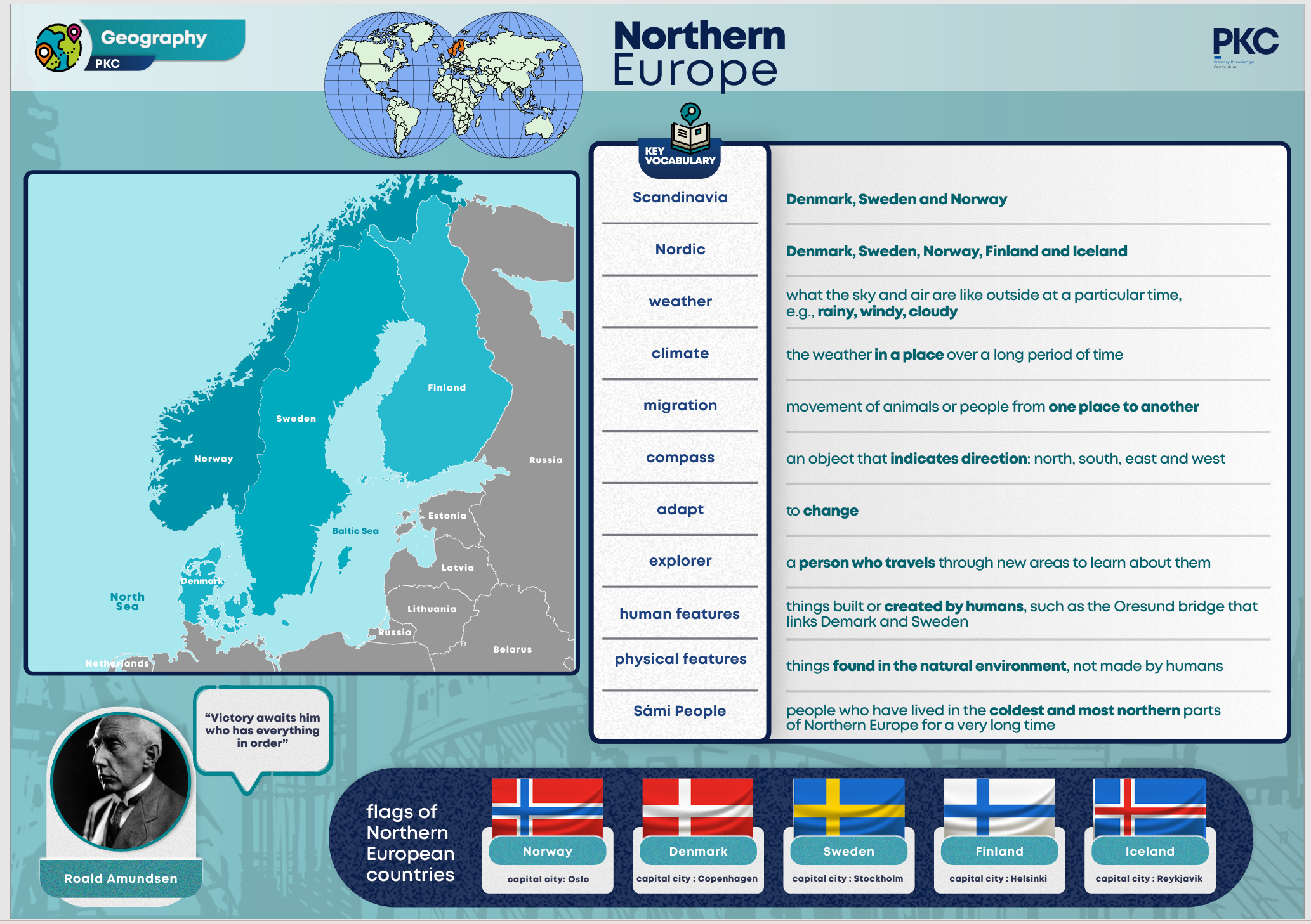
Year 2 – Northern Europe
In this unit, children will begin to develop an understanding of migration and why animals move around the world. Children will also explore the concept of adaptation and consider how people and animals have adapted to survive in cold climates. Within this unit, children will use maps of Northern Europe to identify key countries and key physical features. They will use maps to explore the location of countries such as Denmark, Norway and Sweden. They will recognise human features of the region, such as the Oresund Bridge that links Denmark and Sweden. Children will learn how to read a simple climate graph and compare the climate of a region in Northern Europe to that of the UK. To conclude this unit, children will learn about the explorer Roald Amundsen, who was born in Norway. They will learn about Amundsen’s travels through the Northwest Passage and about his expedition to the South Pole. They will learn how he took advice from the Innuit, who lived in the cold, icy climate of the Arctic Circle.
Year 3 – Western Europe
Within this unit, children will use maps of Western Europe to identify key countries and key physical features. They will use maps to explore the location of countries such as France. Children will learn about France. They will locate Paris, the capital city and will look at maps of the city itself. They will identify the path of the River Seine and the River Rhone, reinforcing their understanding of physical features (rivers) and human features (settlements). They will look closely at images of diverse French landscapes, including the sandy beaches of Southern France, the wine regions and the Alps. They will learn that the Alps are mountains that have high altitude, causing the climate of these regions to be cooler.

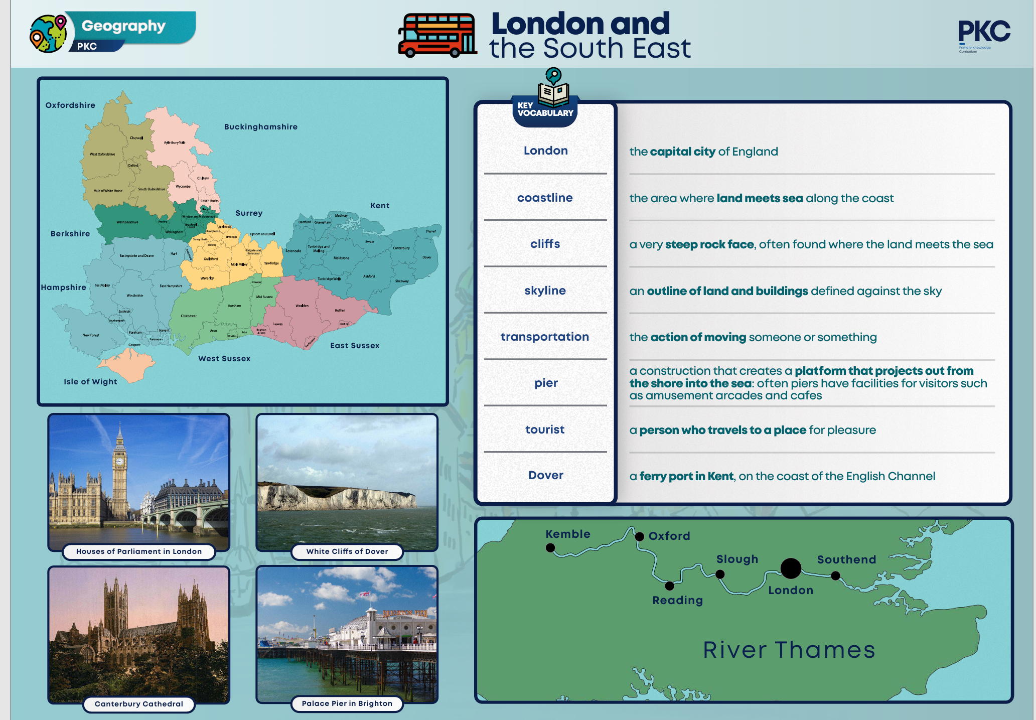
Year 4 – London and the South East
This unit introduces London and the South East of England. Children will build knowledge of the counties and cities of the UK, their geographical regions, human and physical characteristics and topographical features. Over time, as they progress through the curriculum, children are learning more and remembering more about regions of England. During this unit, children will use an atlas to identify key places within the region, including London, Dover, Canterbury and Brighton. In addition, they will look at regional proximities, including the location of France across the English Channel from the south-eastern coast of England.
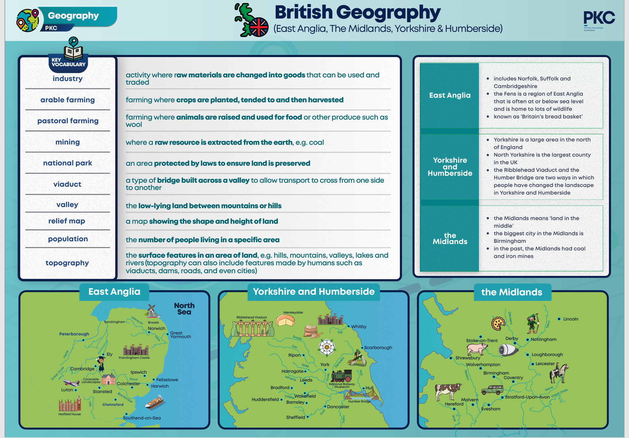
Year 5 – East Anglia and the Midlands
This unit builds on children’s understanding of UK geography and looks closely at the following regions of England; East Anglia, The Midlands, Yorkshire and Humberside. Children will use maps and atlases to locate countries and features of the regions they are studying. They will use relief maps and topographical maps, population data and will look at climate data too. Throughout this unit, children will look at how human activity can change and shape landscapes. They will look at this in different contexts, such as how people drained the Fens to create waterways and land for farming. They will learn how mining in the Midlands provided resources for industrial development. The Ribblehead Viaduct and the Humber Bridge will be studied as examples of how people have changed landscapes.
Year 6 – South American Geography
Children will study the human and physical geography of South America. Within this unit, children will use maps of South America to identify key countries and key physical features, including the Andes Mountains. They will use different maps to identify landscapes, biomes, industry and population distribution. Children will secure locational knowledge as they identify countries within South America. They will build on their knowledge of geology from previous units and will explore why geologists and scientists think South America and Africa were joined many millions of years ago. In this unit, children will learn about the Inca Empire, building on their knowledge of empires from history. Children will explore the interconnection between humans and the environment when they study the Amazon Rainforest and the forest fires that have occurred there in recent years. They will consider the impact human activity has on the environment and the threat it can cause to biodiversity.

![]()